
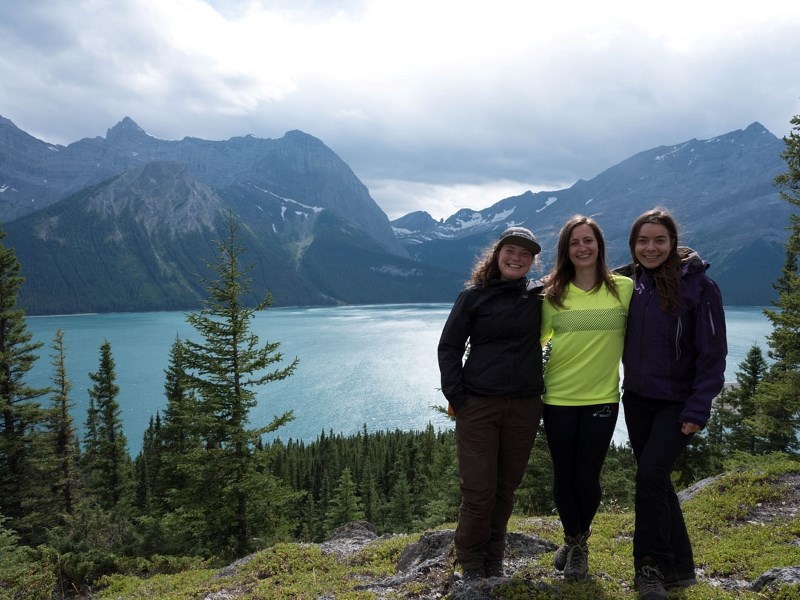
A Cochrane man is hoping outdoor enthusiasts will shed their brightly coloured hiking jackets to help protect researchers who are following in the footsteps of Canada’s pioneers to catalogue changing mountain landscapes.
“When the crews are in the field, they get dropped off on a mountain peak. Most of the gear is browns, greens, greys and blacks – it blends in really well with those rocky landscapes,” explained Rick Arthur, a retired forestry officer with the Mountain Legacy Project. “Worst case scenario, if they’re transiting between stations … and perhaps one of them falls and injures themselves, if they’re wearing black and grey – you’re basically looking at a Where’s Waldo scenario. It’s personal safety.”
The Mountain Legacy Project is a multi-year program for researchers, students, mountaineers and more to re-trace the paths of Canadian surveyors who established the country’s boundaries between the 1880s and 1950s.
As they mapped out the land during the massive undertaking, many workers would also take pictures – a method called phototopographic surveying – which ultimately created the world’s most complete collection of systematic historical mountain photos.
“They would set up a station (and) take literally thousands of shots with their survey equipment,” said Arthur. “The surveying of the mountain regions of western Canada was really considered to be a momentous and historic period in the survey world.”
Much of the collection was lost for years – some were even marked for disposal – until the group began working with Library and Archives Canada and digging for the glass plate images. So far, archivists have unearthed between 125,000 and 140,000 photos.
“They were basically mislabeled in boxes and marked as maps,” Arthur said. “Once we got on to sleuthing things, we were able to find more and more of these surveys.”
With the historic images now in hand, researchers use Google Earth to identify unique features in the pictures and trek up mountains across western Canada during the summer to re-take those photographs and document ecological change.
So far, since 1997, project members have re-photographed thousands of those original images. Arthur said they try to hit about 100 stations a year, and this season crews have covered areas surveyed between 1916 and 1948 in the Highwood, Sheep, Elbow, and Kananaskis areas. The brightly-coloured jackets help increase visibility for those project members in the vast wilderness of the Rockies.
“It’s really helped us,” he said, adding anyone with a clothing donation can contact him directly on Facebook.
Ultimately, Arthur said the Mountain Legacy Project (www.mountainlegacy.ca) hopes to shed light on why ecosystems and landscapes change over time, and to encourage discussion about public lands management.


